


Saint Guilleme

Maca8284
User
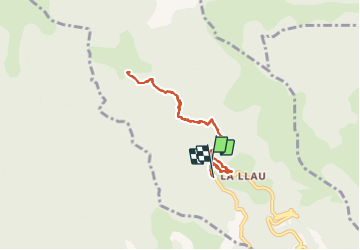

Length
7.4 km

Max alt
1289 m

Uphill gradient
412 m
Km-Effort
12.9 km

Min alt
895 m

Downhill gradient
394 m
Boucle
Yes
Creation date :
2021-10-08 12:44:48.818
Updated on :
2021-10-08 16:21:54.004
3h32
Difficulty : Medium

FREE GPS app for hiking
 SityTrail
IGN / Geographical institutes
SityTrail Plus
The world is yours!
About
Trail Walking of 7.4 km to be discovered at Occitania, Pyrénées-Orientales, Le Tech. This trail is proposed by Maca8284.
Positioning
Country:
France
Region :
Occitania
Department/Province :
Pyrénées-Orientales
Municipality :
Le Tech
Location:
Unknown
Start:(Dec)
Start:(UTM)
459621 ; 4698778 (31T) N.
Comments